Hurricane Isaias- 8/1/20 Morning Update

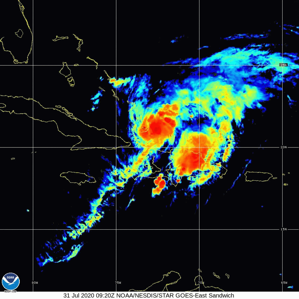
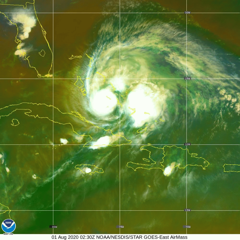
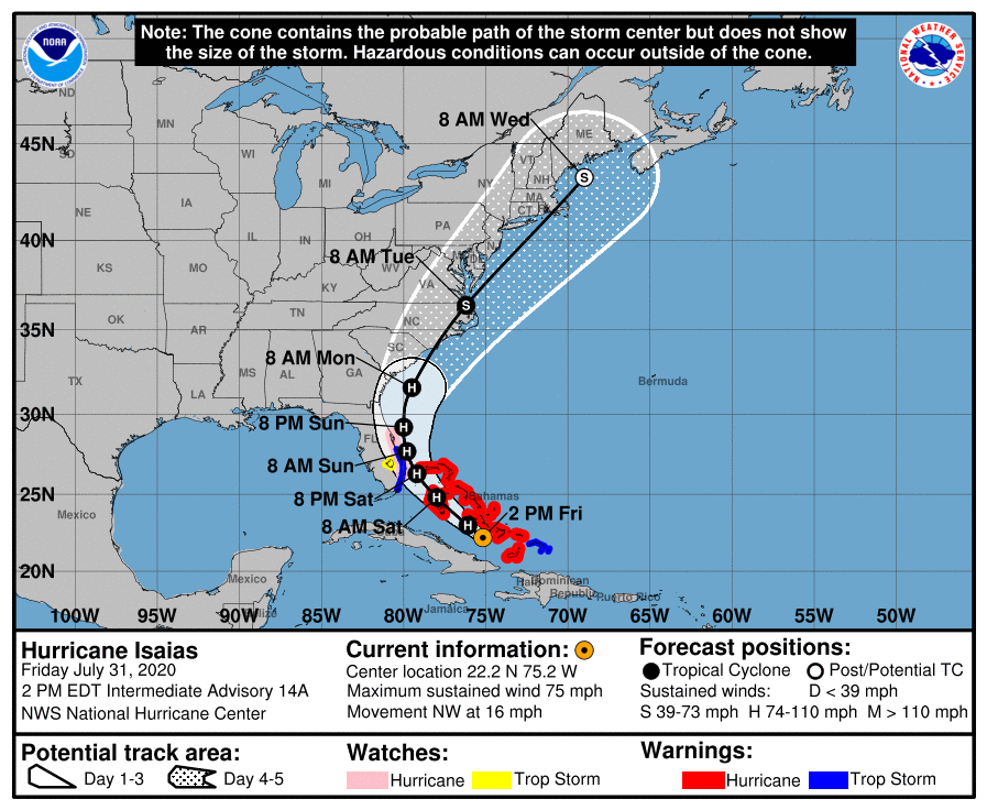
As of this morning, Hurricane Isaias is moving northwestward through the Bahamas. Isaias’ satellite appearance is somewhat disorganized and it has remained level in-terms of strength. Throughout this morning and this afternoon little strengthening is expected as Isaias will continue to struggle with dry air and wind-shear. Isaias will approach the coast of Florida late tonight through early Monday morning and begin to weaken. From there it will turn North and head up along the coast. At this point in time, I am still not confident in a specific forecast, though it does look likely that we will at minimum see some rain connected with the remnants of Isaias. 

For now it looks like the impacts to our region will be minimal outside of the potential for moderate to heavy rains and minor winds. We should all keep a close eye on Isaias as the forecast with storms like this are always difficult to nail down in the long range. More to come later today as needed.

Hurricane Isaias

I have begun to receive many questions about Hurricane Isaias and it’s potential impacts on our region. While it is true that we may be impacted by the storm, it is far too early to make any accurate predictions regarding it’s impact.  While we are currently within the cone of uncertainty, at this range the track is likely to change significantly over the coming days.

Based on current model guidance, it does not appear that we should expect a strong Hurricane to impact us. Isaias is a storm that we should all be keeping our eyes on, but as of now it looks like any impact in our region will be limited to heavy rainfall and a minor wind event.


January 18th Minor Snow Event

Overall this year has been relatively quiet when it comes to major snow storms, and that trend looks to continue in the near future. However, we are expecting a minor snowfall tomorrow throughout the region. As of this morning, it appears that this will be a low impact event, likely ending with some light drizzle. Snow will be begin mid-late morning as light to moderate snow, which will continue into the afternoon. By the late afternoon and early evening, temperatures will begin to rise and whatever precipitation falls during that time period will likely be in the form of light sleet or rain. By the conclusion of the event, you can expect a coating to two inches.

Temperatures should warm into the upper 30’s on Sunday which should help some of the snow melt. However, overnight Sunday into Monday temperatures will drop into the 20’s leading to the remaining snow and standing water to freeze.


12/11/19 Rain to Snow Event

Sorry for the delay in getting this update out to you, I have been out of town for work and traveling the last few days.

With that said, we’re in-store for another rainy/snowy morning commute tomorrow. Based on current model guidance, the rain that we’re experiencing this afternoon and into this evening will transition to snow sometime in the early morning hours before sunrise tomorrow. This will lead to a slippery and snowy commute in the morning. The snow will end from West to East by the late morning hours. By the time it is done you can expect anywhere from a coating to three inches of snow region-wide.

I’d be remiss in my sharing of information if I did not mention that the latest run of the HRDPS gives us almost 6 inches throughout the area, but it is an outlier at this time. Most other model guidance is falling in the 1-3/2-4 inch range. I’m leaning towards the middle/low-end of that range simply because of the preceding rain and warmer temperatures which will cause the snow to have some difficulty accumulating early on, especially on paved surfaces.


12/1/19-12/3/19 Snow/Rainstorm Update- Will it Snow?

While, I hoped to come to you this morning with a definitive forecast, alas the weather gods have not been kind. There is still a significant amount of disagreement in the model guidance on what to expect tomorrow. I’m going to outline my best guess below, but the general takeaway is that today everyone from NYC East can expect snow/sleet changing to rain during the day. The rain will continue until until early tomorrow morning. Then mid-day tomorrow is when things get dicey and we may or may not see accumulating snow. Overall, expect anywhere from a coating to 4 inches of snow by Tuesday morning.

Detailed Discussion:

While it is clear that this afternoon into this evening will feature light to moderate rain showers throughout the day, there is still a significant amount of uncertainty around what occurs tomorrow. Model guidance has been shifting back and forth over the last 24-48 hours with the track of the low pressure systems by about 25-50 miles. While this may not seem like much, it is the difference between our area seeing a coating of snow at best vs 2-5 inches of snow.

What is clear is that by mid-day tomorrow an area of low pressure will develop somewhere just off the New Jersey coastline. From there, the low will either track east just south of Long Island or head SSE. They key to everything is how far south and east the initial low forms. If it forms where the GFS and HRDPS currently have it modeled right over the New Jersey Coastline, and fairly north, we may not see much snow at all. While if it follows the NAM track, and forms about 30 miles further SE, we likely will see a few inches of snow late Monday night. Either way, this will not be a high impact event, it will be more of a nuisance event then one that will cause much disruption.