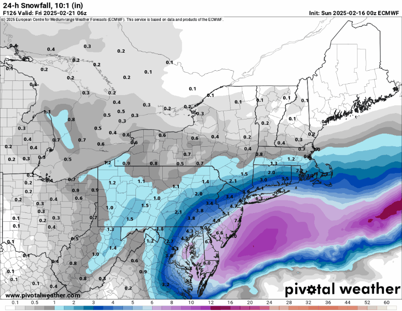
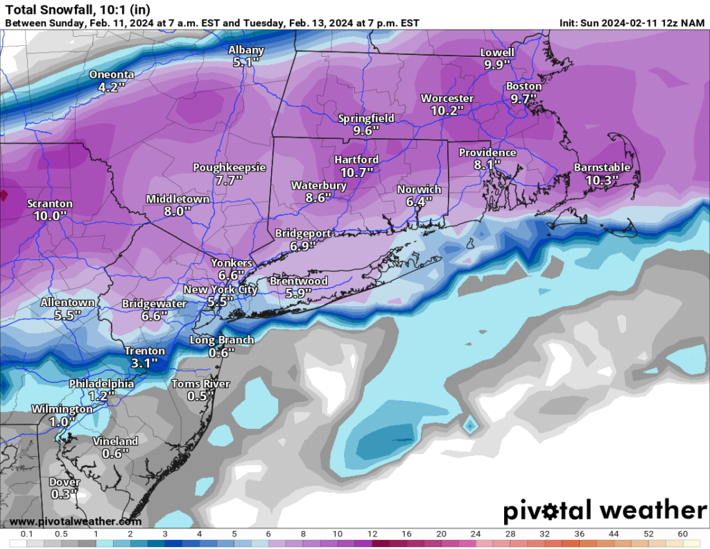
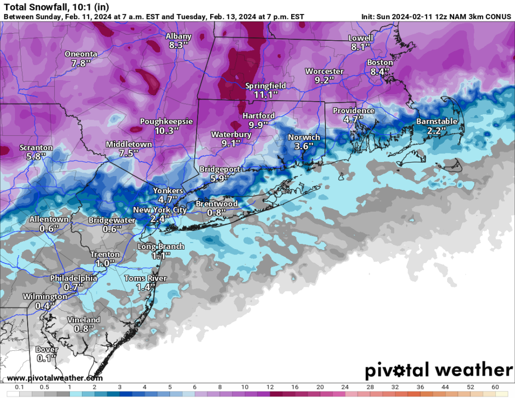
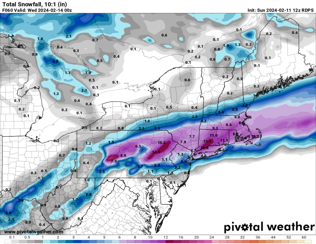
As of this afternoon, the winter storm we’ve been tracking since Friday appears increasingly unlikely to materialize. While early projections suggested a significant snowfall event, the latest model trends continue to weaken the system—some even indicating a complete miss. What once looked like a blockbuster storm is now shaping up to be, at best, a minor inconvenience.
The key shift in the forecast comes down to how energy over the Pacific is interacting with the atmosphere. Initially, conditions seemed favorable for a strong low-pressure system to develop along the East Coast and merge with energy diving in from Canada. However, over the past 48 hours, updated models show the Pacific energy pushing ahead too quickly, preventing the necessary phasing of these systems. Without this connection, the storm loses its punch, reducing the chance of a significant snow event.
While I’ll continue to monitor developments, as it stands now, expect only a few inches of snow late Wednesday night into Thursday morning. Stay tuned for further updates!