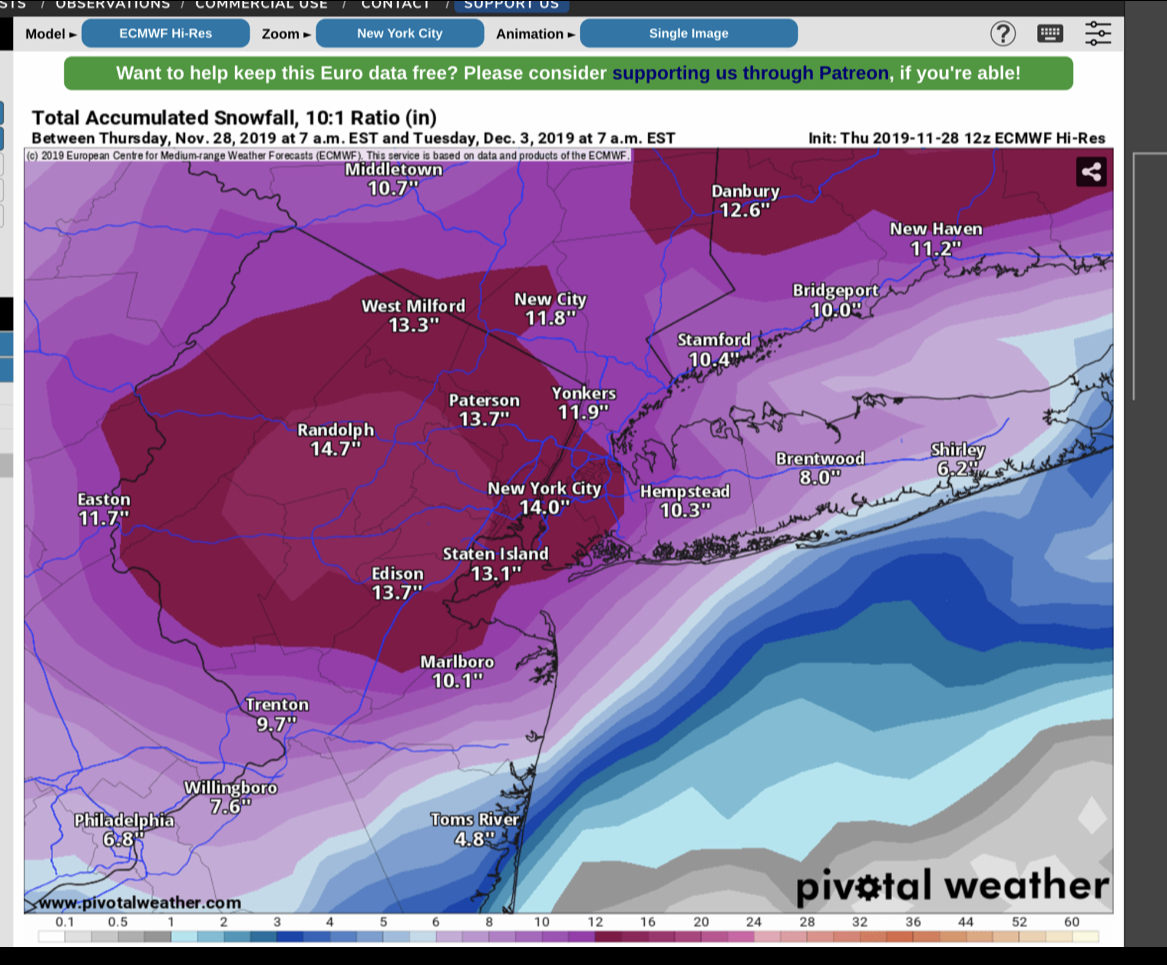
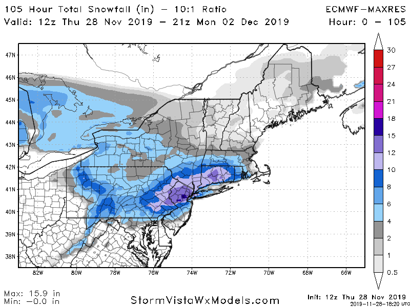
Let’s start with the good news: Almost all the models have backed off the idea of a heavy snowfall for Long Island and NYC. They do keep the idea of snow, possibly over a foot in the forecast for areas to the North and West of NYC.
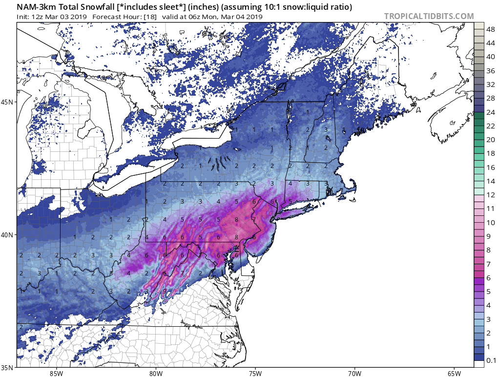
Now the bad news: Starting mid-day tomorrow the weather will deteriorate as a low pressure system will begin to move through the region. Expect rain, with the possibility of mixed precipitation to overspread the area from west to east by late morning. The rain with some sleet/snow mixed in will continue through Sunday night into early Monday morning. This is the point where we can expect the rain to transition to snow, and some areas of NYC and Long Island may see a couple inches of snow by Monday evening. Most models move the precipitation out by late Monday night, with the latest run of the NAM having some precipitation hanging around until late Monday night into Tuesday morning. At this point the takeaway is that we will have a few days of unsettled weather, with the chance of a few inches of snowfall by Monday evening.
I should have a better idea by mid to late tomorrow on any changes in regards to snowfall as it all depends on where the low pressure system begins to transfer and then intensifies south of Long Island. I know I usually post snow forecast maps at this point, but I will not be posting any since they are inaccurate due to all the mixed precipitation that will be occurring with this system.
 I have not posted much about tomorrows event, simply because I’m not that impressed by it. Overall, we’re looking at a minor winter weather event for the area. Snow will begin tomorrow morning between 7 AM and 9 AM. Snow will continue throughout the morning before changing to sleet sometime around mid-day. Finally in the late afternoon or early evening the sleet will change over to rain. The further East you are the earlier the earlier the changeover to rain, the further North and West, the longer the sleet/snow will hold on.