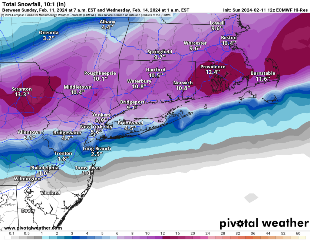
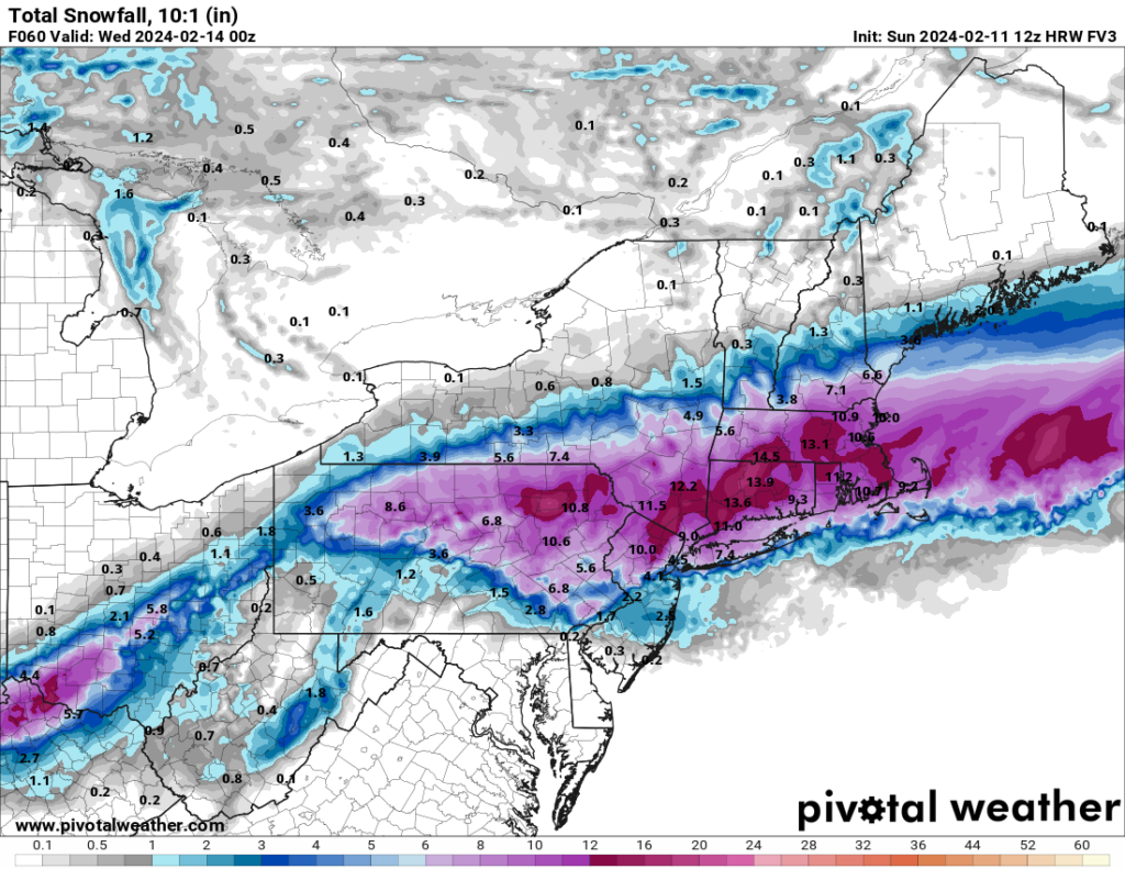
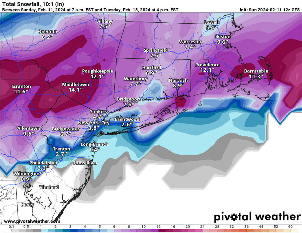
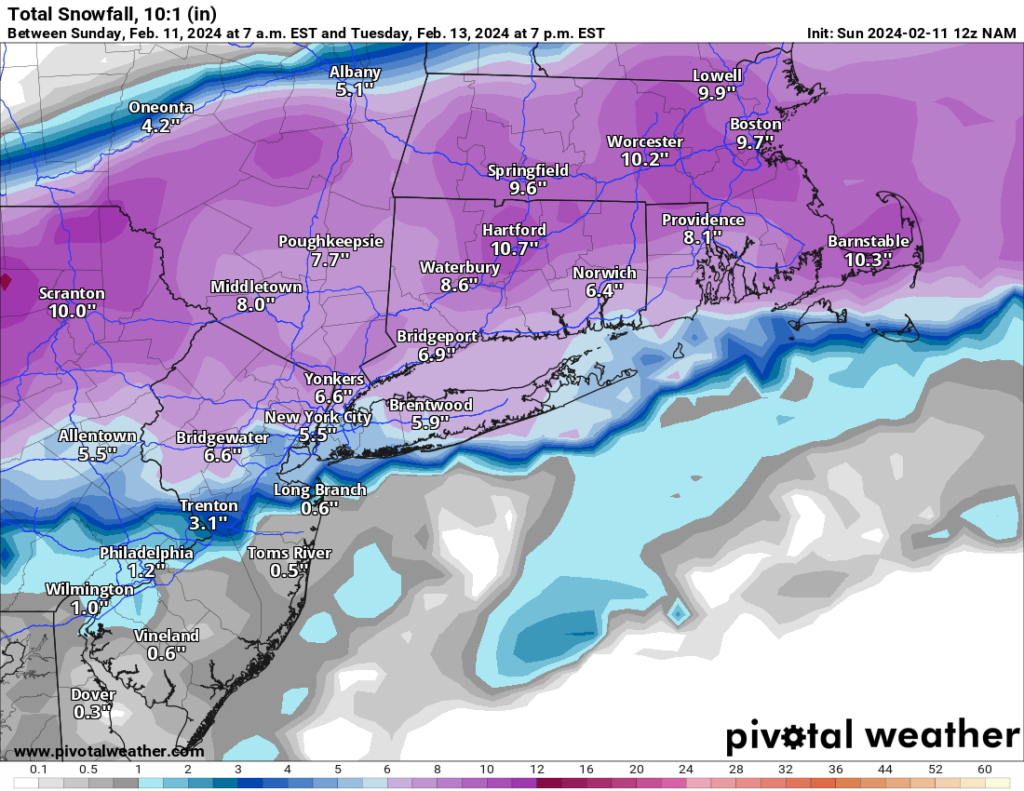
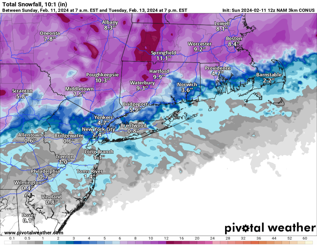
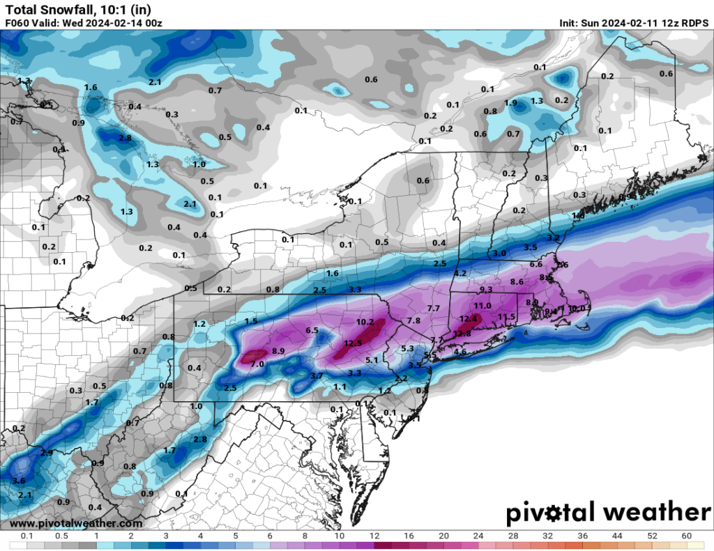
I have been slow to post anything related to the storm coming on Tuesday. The primary reason for this is that I truly have no idea what to expect on Tuesday. As of this afternoon’s model runs, we should expect anywhere from a wet inch or two to 6–10 inches of snowfall. Everything is coming down to a 25 or so mile difference in storm track as well as models varying by 2–5 degrees on the projected temperature. Any swing warmer/north means almost now snow, and a slight bump south/colder means a significant snowfall. We likely will not know for sure until sometime tonight or tomorrow what to expect on Tuesday.
Overall, you can expect rain to overspread the area Monday night into early Tuesday morning. Depending on the model and forecast temperatures, the rain will change over to snow sometime around sunrise. Depending on the surface temperatures, the snow may begin to accumulate fairly quickly. The snow should begin to end by mid-to-late afternoon on Tuesday.
I plan to post an update tomorrow with a specific snowfall prediction. For now, expect at least an inch or two of snow, with a 50–60% possibility for 5+.”