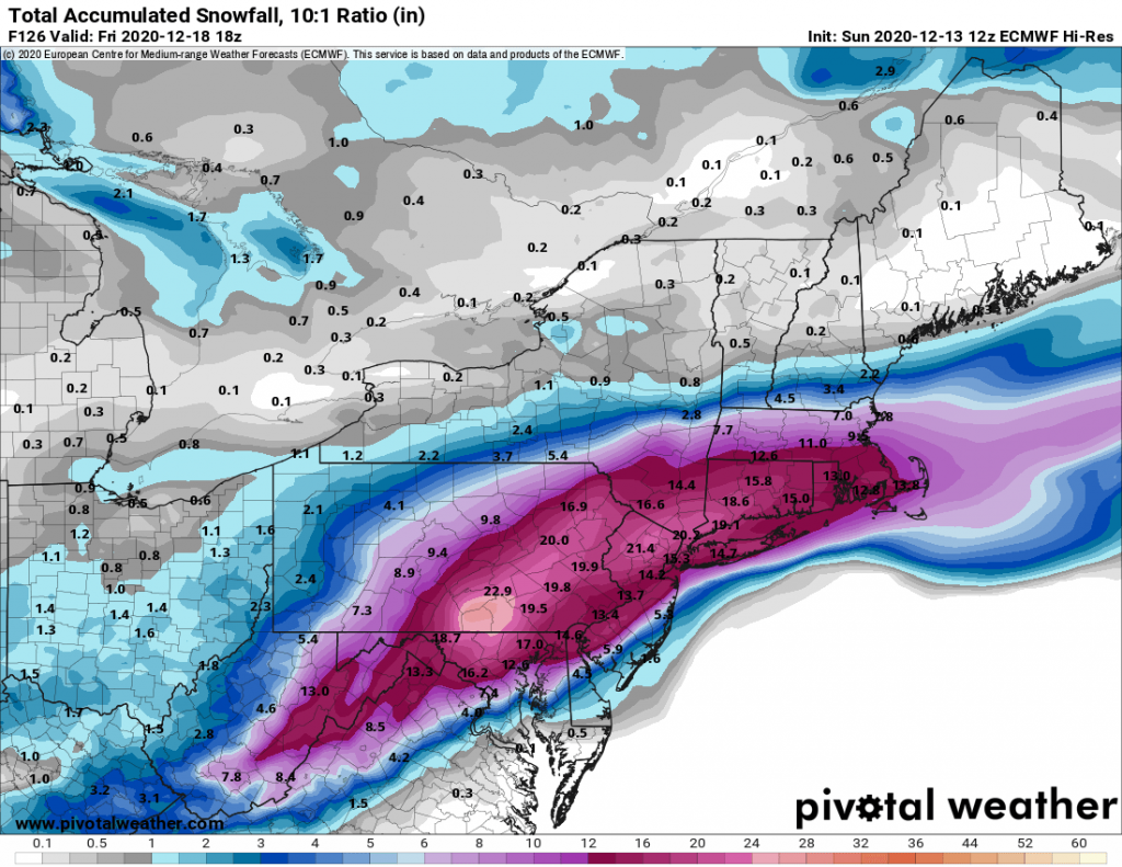
 It continues to look likely that we will be impacted by a significant snowstorm Wednesday evening through Thursday morning. The weather models while divergent in totals, generally agree that a significant storm will impact our area. The only question that exists as of this evening is in regards to the exact track of the low. A few models on their runs this afternoon trended slightly North which brought more mixed precipitation to Long Island while leaving the city and areas North and West of the city in heavy snow bands. We will have to wait until either tomorrow evening or Tuesday to make a better determination in regards to these slight shifts in track.
With that being said light snow should start Wednesday afternoon and pick-up in intensity through the evening. The snow will be heavy overnight, with a chance for thundersnow, as the low pressure system will be intensifying rapidly south of Long Island. Blizzard conditions will also likely occur overnight, and I would not be surprised to see Blizzard Warning’s issued for parts of our region. The snow will begin to wind down around sunrise on Thursday morning.
My initial snow total forecast is as follows and is likely to be revised as we get closer in:
NYC and Long Island: 8-14″
Areas North and West of NYC 14-20″

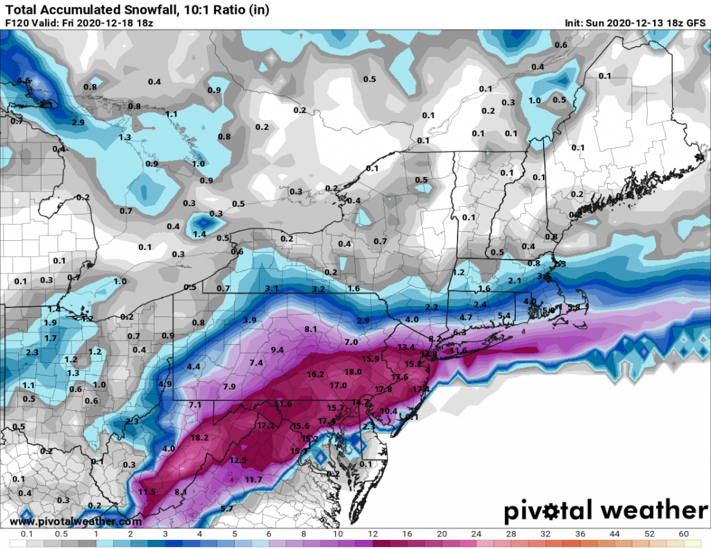
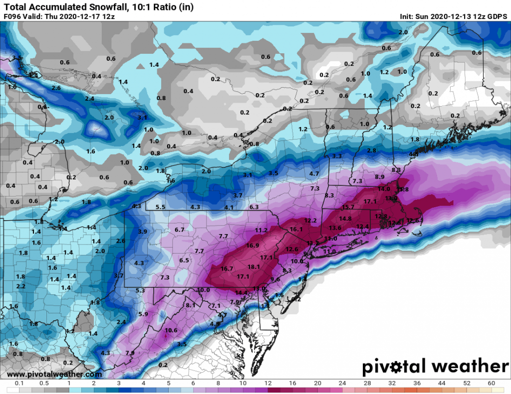
Euro 18Z GFS 18Z CMC