After a long pause due to the addition of two little nuggets to our clan and the associated exhaustion, I am back with an update for you!
As you may have have heard, we are now under a Winter Storm Watch for a potential snow storm from late Friday night through Saturday evening. What you also may have heard is that no one truly knows how much snow we can expect yet and the timing.
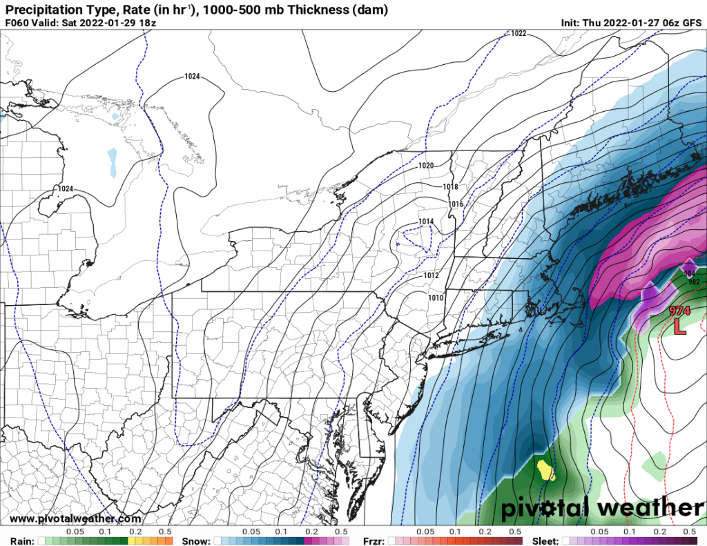
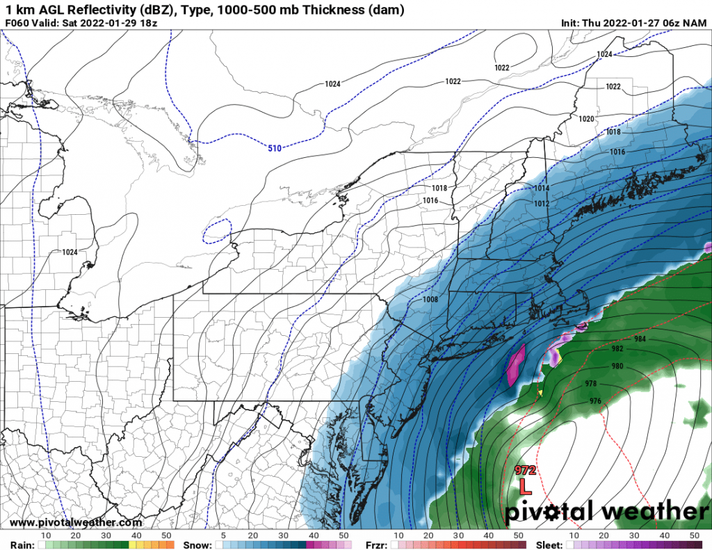
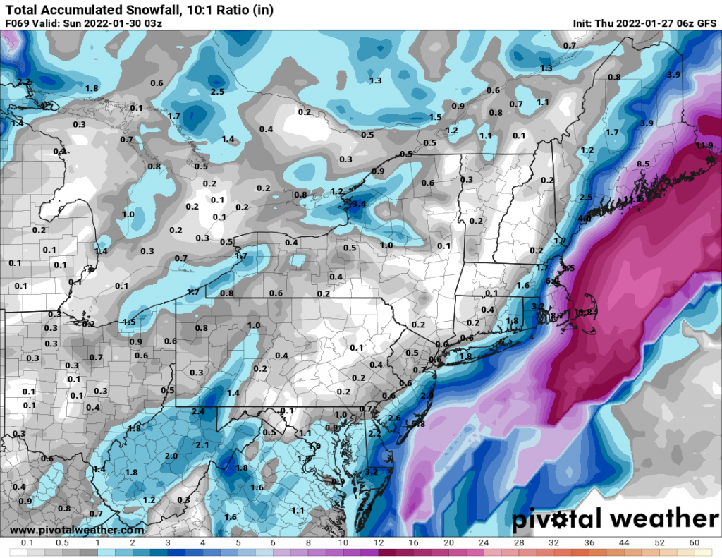
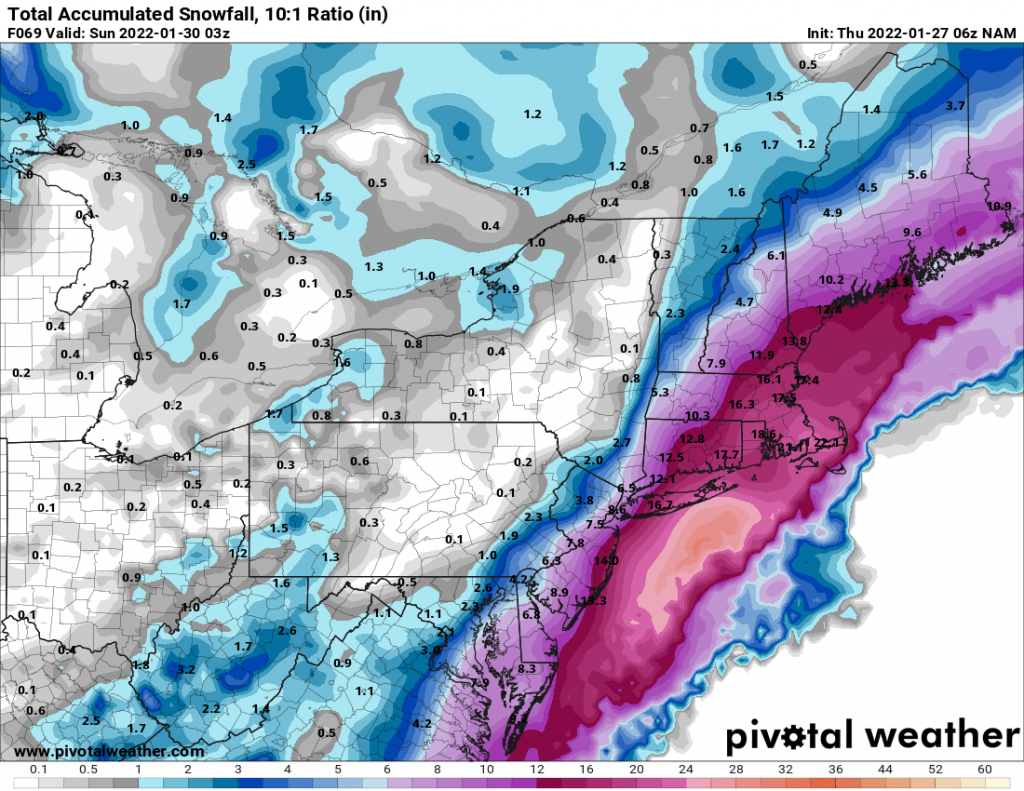
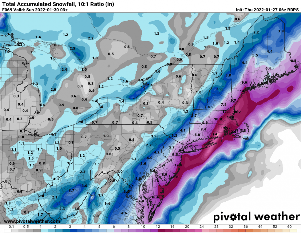
The main reason for this is a piece of upper air energy over Canada that is currently not well sampled, and the models are only guessing at how strong it is based on limited data. This area of energy is what will make the difference between a strong storm for our area and a minor light snow event. The NAM has the area of energy much stronger, driving in to the trough and strengthening the system while the GFS has it much weaker, and holding back not interacting with our storm. Below, you can see the impact this different handling of the energy is having on the models. We likely won’t know much more until later this afternoon or evening as the energy becomes better sampled.
The key takeaway for now is that we currently should expect a 6-12 inch snowstorm, but I would only put this forecast at 60% confidence as of now. The other 40% is split on either side of more or less snow, all depending on the energy in Canada. This is a thread the needle situation, that may not be fully settled for another 24 hours.